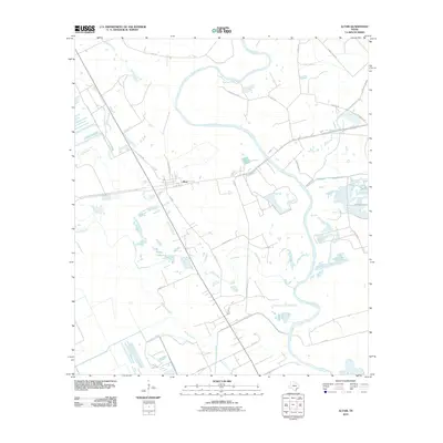
2010 Map of Altair
USGS Topo · Published 2010About this map
The settlement of Altair sits at the heart of this coastal plains landscape in Colorado County, where the sprawling bends of the Colorado River dominate the eastern half of the map. This area is defined by its complex drainage systems, featuring significant water bodies such as Muddy Lake and the winding paths of Skull Creek and Marys Branch. The intersection of Us HWY 90 Alt provides the primary transit corridor through the region, connecting local agricultural and industrial operations via roads like Prairie Plant Rd and River Plant Rd.
Find a feature on this map
31 named features on this map. Tap any name to fly to it.
Don’t see what you’re looking for? This feature index may not catch every label — zoom into the map to look around manually.
Map Details
Editions of this 2010 Altair Map
This is the sole edition of this map. No revisions or reprints were ever made.
Other maps of this area

1953 · Seguin
USGS Topo · 1:250,000

1956 · Glidden
USGS Topo · 1:62,500

1957 · Eagle Lake
USGS Topo · 1:62,500

1957 · Altair
USGS Topo · 1:24,000

1957 · Columbus
USGS Topo · 1:24,000

1958 · Seguin
USGS Topo · 1:250,000

1958 · Alleyton
USGS Topo · 1:24,000

1959 · Garwood
USGS Topo · 1:24,000

1959 · Bonus
USGS Topo · 1:24,000
1963 · Eagle Lake
USGS Topo · 1:24,000