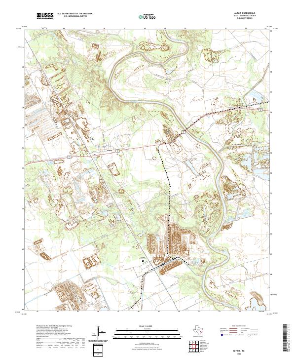
2022 Map of Altair
USGS Topo · Published 2022About this map
The Colorado River meanders through this portion of Colorado County, defining a landscape of low-lying wetlands and complex drainage patterns. The settlement of Altair serves as the primary hub, situated near the intersection of Alt 90 and FM 102. Local history and genealogy are anchored by rural burial sites such as Reels Bend Cem near the river's northern bend and Williams Paradise Cem further south. The terrain is marked by numerous water bodies including Muddy Lake, Heller Lake, and various tributaries like Skull Cr and McKenzie Cr. The presence of the Leher Canal and numerous irrigation-adjacent features suggests a landscape deeply tied to the agricultural water management of the Texas coastal plain. Researchers will find a dense network of country roads, including Old Altair Rd and Pecan Valley Rd, providing access to the area's scattered homesteads.
Find a feature on this map
44 named features on this map. Tap any name to fly to it.
Don’t see what you’re looking for? This feature index may not catch every label — zoom into the map to look around manually.
Map Details
Editions of this 2022 Altair Map
This is the sole edition of this map. No revisions or reprints were ever made.
Other maps of this area

1953 · Seguin
USGS Topo · 1:250,000

1956 · Glidden
USGS Topo · 1:62,500

1957 · Eagle Lake
USGS Topo · 1:62,500

1957 · Altair
USGS Topo · 1:24,000

1957 · Columbus
USGS Topo · 1:24,000

1958 · Seguin
USGS Topo · 1:250,000

1958 · Alleyton
USGS Topo · 1:24,000

1959 · Garwood
USGS Topo · 1:24,000

1959 · Bonus
USGS Topo · 1:24,000
1963 · Eagle Lake
USGS Topo · 1:24,000