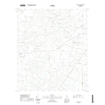
2020 Map of Altamaha SW
USGS Topo · Published 2020About this map
McTier and the surrounding rural landscape of Appling County are defined by a complex network of wetlands and creek systems. Waterways such as Little Satilla Cr and Tenmile Cr drain the region, while smaller tributaries like Alisons Cr and Finemile Cr carve through the coastal plain. The settlement pattern is largely decentralized, anchored by small communities like Zion and Bethel. Local history is preserved in scattered family and community burial grounds, including Easons Cem, Joyner Cem, and Davis Cem, which provide specific points of interest for genealogical research. The road network, featuring names like Zion Baptist Church Rd and Old Field Cemetery Rd, reflects the long-standing importance of these local institutions in the social fabric of south Georgia.
Find a feature on this map
73 named features on this map. Tap any name to fly to it.
Don’t see what you’re looking for? This feature index may not catch every label — zoom into the map to look around manually.
Map Details
Editions of this 2020 Altamaha SW Map
This is the sole edition of this map. No revisions or reprints were ever made.
Other maps of this area

1953 · Waycross
USGS Topo · 1:250,000

1958 · Waycross
USGS Topo · 1:250,000
1970 · Altamaha
USGS Topo · 1:24,000

1970 · Baxley NE
USGS Topo · 1:24,000
1970 · Altamaha SE
USGS Topo · 1:24,000
1970 · Altamaha SW
USGS Topo · 1:24,000
1970 · Tison
USGS Topo · 1:24,000

1970 · Baxley
USGS Topo · 1:24,000
1971 · Odum
USGS Topo · 1:24,000

1971 · Surrency
USGS Topo · 1:24,000