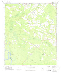
1970 Map of Tison
USGS Topo · Published 1974About this map
The Altamaha River defines the southwestern boundary of this Georgia landscape, marking the border between Tattnall and Appling counties. The interior terrain is characterized by a high density of rural community centers, particularly visible through numerous small church and cemetery clusters such as Pine View Ch Cem, Stony Hill Ch Cem, and Hopewell Ch. These sites serve as vital anchors for local genealogy and land history.
Find a feature on this map
27 named features on this map. Tap any name to fly to it.
Don’t see what you’re looking for? This feature index may not catch every label — zoom into the map to look around manually.
Map Details
Editions of this 1970 Tison Map
2 editions found
Other maps of this area

1919 · Claxton
USGS Topo · 1:62,500

1920 · Glennville
USGS Topo · 1:62,500

1944 · Claxton
USGS Topo · 1:62,500

1944 · Glennville
USGS Topo · 1:62,500

1946 · Brunswick
USGS Topo · 1:250,000

1947 · Savannah
USGS Topo · 1:250,000

1948 · Brunswick
USGS Topo · 1:250,000

1948 · Savannah
USGS Topo · 1:250,000

1950 · Glennville
USGS Topo · 1:62,500

1950 · Claxton
USGS Topo · 1:62,500