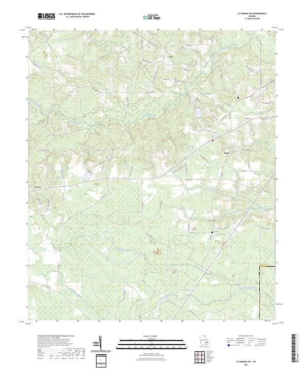
2024 Map of Altamaha SW
USGS Topo · Published 2024About this map
Little Satilla Creek and its various tributaries, including Alisons Creek and Fivemile Creek, define the low-lying drainage of this Appling County landscape. The area is characterized by a network of rural routes named for local families, such as Maude Lamb Rd, Murphy Rd, and Will Sellers Rd, reflecting deep-rooted land ownership patterns. Small settlements like Zion, Bethel, and McTier are scattered across the terrain, often centered around family-named landmarks or historic burial grounds. Genealogists can find several preserved sites including Joyner Cem, Easons Cem, and the Old Field Cemetery. The northern portion features larger water bodies like Eason Lake, while the southern reaches are marked by the county line shared with Wayne County.
Find a feature on this map
73 named features on this map. Tap any name to fly to it.
Don’t see what you’re looking for? This feature index may not catch every label — zoom into the map to look around manually.
Map Details
Editions of this 2024 Altamaha SW Map
This is the sole edition of this map. No revisions or reprints were ever made.
Other maps of this area

1953 · Waycross
USGS Topo · 1:250,000

1958 · Waycross
USGS Topo · 1:250,000
1970 · Altamaha
USGS Topo · 1:24,000

1970 · Baxley NE
USGS Topo · 1:24,000
1970 · Altamaha SE
USGS Topo · 1:24,000
1970 · Altamaha SW
USGS Topo · 1:24,000
1970 · Tison
USGS Topo · 1:24,000

1970 · Baxley
USGS Topo · 1:24,000
1971 · Odum
USGS Topo · 1:24,000

1971 · Surrency
USGS Topo · 1:24,000