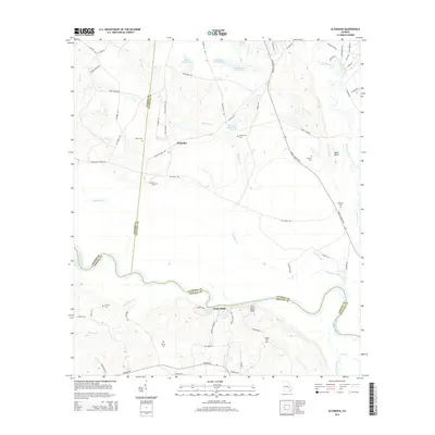
2014 Map of Altamaha
USGS Topo · Published 2014About this map
The Altamaha River carves a winding path through this region where Toombs, Tattnall, and Appling counties meet. The landscape is defined by its riparian complexity, featuring numerous bluffs such as Eason Bluff and Iron Mine Bluff that rise above the southern riverbanks. Away from the water, the settlement of Altamaha sits at a crossroads, surrounded by a dense network of family-named roads like Ba Darley Rd and Elza District Rd.
Find a feature on this map
74 named features on this map. Tap any name to fly to it.
Don’t see what you’re looking for? This feature index may not catch every label — zoom into the map to look around manually.
Map Details
Editions of this 2014 Altamaha Map
This is the sole edition of this map. No revisions or reprints were ever made.
Other maps of this area

1953 · Waycross
USGS Topo · 1:250,000

1957 · Macon
USGS Topo · 1:250,000

1958 · Macon
USGS Topo · 1:250,000

1958 · Waycross
USGS Topo · 1:250,000

1964 · Macon
USGS Topo · 1:250,000

1970 · Johnson Corner
USGS Topo · 1:24,000

1970 · Reidsville West
USGS Topo · 1:24,000
1970 · Reidsville East
USGS Topo · 1:24,000
1970 · Altamaha
USGS Topo · 1:24,000

1970 · Baxley NE
USGS Topo · 1:24,000