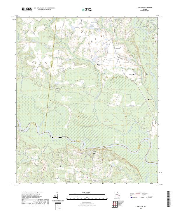
2024 Map of Altamaha
USGS Topo · Published 2024About this map
Altamaha serves as the focal point for this rural landscape where the boundaries of Toombs, Tattnall, and Appling counties meet. The geography is defined by the winding course of the Altamaha River, which is flanked by distinctive landmarks like Iron Mine Bluff, Eason Bluff, and Moon Bluff. These riverbank features, along with names like Ironman Bluff, suggest a history of resource extraction and strategic river navigation in this part of South Georgia.
Find a feature on this map
78 named features on this map. Tap any name to fly to it.
Don’t see what you’re looking for? This feature index may not catch every label — zoom into the map to look around manually.
Map Details
Editions of this 2024 Altamaha Map
This is the sole edition of this map. No revisions or reprints were ever made.
Other maps of this area

1953 · Waycross
USGS Topo · 1:250,000

1957 · Macon
USGS Topo · 1:250,000

1958 · Macon
USGS Topo · 1:250,000

1958 · Waycross
USGS Topo · 1:250,000

1964 · Macon
USGS Topo · 1:250,000

1970 · Johnson Corner
USGS Topo · 1:24,000

1970 · Reidsville West
USGS Topo · 1:24,000
1970 · Reidsville East
USGS Topo · 1:24,000
1970 · Altamaha
USGS Topo · 1:24,000

1970 · Baxley NE
USGS Topo · 1:24,000