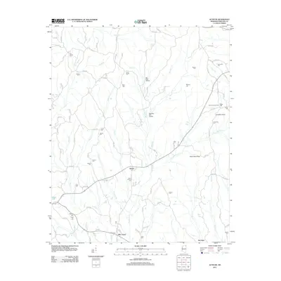
2012 Map of Altitude
USGS Topo · Published 2012About this map
Altitude and Hills Chapel serve as the primary community centers in this section of Prentiss County, Mississippi. The landscape is defined by the headwaters of numerous small waterways, including Big Brown Cr and Brush Cr, which have carved out distinct terrain features like Big Rock Hollow and Heading Mill Hollow. A high concentration of family and community burial grounds, such as New Candler Cem, Snowdown Cem, and Jones Chapel Cem, reflects the long-standing genealogical roots of this rural area.
Find a feature on this map
115 named features on this map. Tap any name to fly to it.
Don’t see what you’re looking for? This feature index may not catch every label — zoom into the map to look around manually.
Map Details
Editions of this 2012 Altitude Map
This is the sole edition of this map. No revisions or reprints were ever made.
Other maps of this area

1921 · Booneville
USGS Topo · 1:48,000

1922 · Booneville
USGS Topo · 1:62,500

1935 · Holcut
USGS Topo · 1:24,000

1935 · Leedy
USGS Topo · 1:24,000

1935 · Glens
USGS Topo · 1:24,000

1950 · Corinth
USGS Topo · 1:62,500

1950 · Paden
USGS Topo · 1:24,000
1950 · Burnsville
USGS Topo · 1:24,000

1950 · Glens
USGS Topo · 1:24,000

1950 · Altitude
USGS Topo · 1:24,000