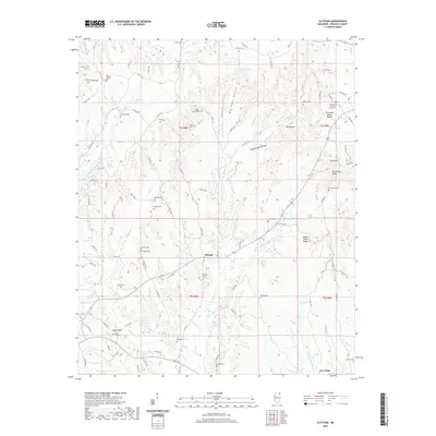
2020 Map of Altitude
USGS Topo · Published 2020About this map
Altitude sits at the heart of this Prentiss County survey, where the topography is defined by the Tennessee Valley Divide and a series of hollows. The landscape is deeply carved by drainage systems including Big Brown Cr, Brush Cr, and Martin Cr. For genealogists and local historians, the area is notable for its numerous small family and community burial grounds, such as Jones Chapel Cem, Mount Pleasant Cem, and Martin Hill Cem, which are scattered throughout the rural terrain. The settlement of New Hope appears in the southeast, anchored by the nearby Bullard Cem. Water features such as Walden Lake and the winding course of Big Rock Hollow illustrate the varied elevations of this region, while landmarks like Round Hill and Blue Hill provide distinctive points of reference in the northeastern section of the quadrangle.
Find a feature on this map
112 named features on this map. Tap any name to fly to it.
Don’t see what you’re looking for? This feature index may not catch every label — zoom into the map to look around manually.
Map Details
Editions of this 2020 Altitude Map
This is the sole edition of this map. No revisions or reprints were ever made.
Other maps of this area

1921 · Booneville
USGS Topo · 1:48,000

1922 · Booneville
USGS Topo · 1:62,500

1935 · Holcut
USGS Topo · 1:24,000

1935 · Leedy
USGS Topo · 1:24,000

1935 · Glens
USGS Topo · 1:24,000

1950 · Corinth
USGS Topo · 1:62,500

1950 · Paden
USGS Topo · 1:24,000
1950 · Burnsville
USGS Topo · 1:24,000

1950 · Glens
USGS Topo · 1:24,000

1950 · Altitude
USGS Topo · 1:24,000