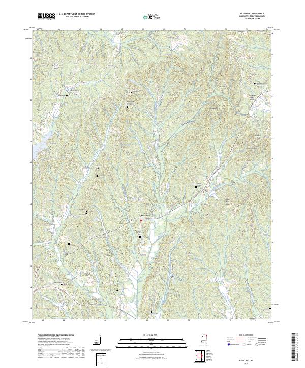
2024 Map of Altitude
USGS Topo · Published 2024About this map
Altitude serves as a central point in this topographic study of Prentiss County, positioned amidst a complex network of drainage basins including Big Brown Creek and Martin Creek. The landscape is defined by the Tennessee Valley Divide, which separates the regional watersheds, while prominent terrain features like Riddle Wind Ridge and Round Hill suggest a varied elevation profile. This area is characterized by a high density of rural cemeteries and churches, indicating a long-settled community with deep genealogical roots.
Find a feature on this map
114 named features on this map. Tap any name to fly to it.
Don’t see what you’re looking for? This feature index may not catch every label — zoom into the map to look around manually.
Map Details
Editions of this 2024 Altitude Map
This is the sole edition of this map. No revisions or reprints were ever made.
Other maps of this area

1921 · Booneville
USGS Topo · 1:48,000

1922 · Booneville
USGS Topo · 1:62,500

1935 · Holcut
USGS Topo · 1:24,000

1935 · Leedy
USGS Topo · 1:24,000

1935 · Glens
USGS Topo · 1:24,000

1950 · Corinth
USGS Topo · 1:62,500

1950 · Paden
USGS Topo · 1:24,000
1950 · Burnsville
USGS Topo · 1:24,000

1950 · Glens
USGS Topo · 1:24,000

1950 · Altitude
USGS Topo · 1:24,000