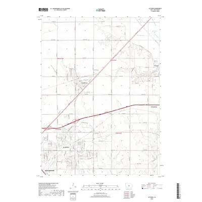
2018 Map of Altoona
USGS Topo · Published 2018About this map
The growing suburban landscape of Polk County is documented here during a period of rapid development northeast of Des Moines. The city of Altoona anchors the southern portion of the sheet, where major thoroughfares like Adventureland Dr NE and Hubbell Ave intersect with an expanding grid of residential streets. Further north, the town of Bondurant sits at the junction of Co Rd F38 and Hubbell Ave, surrounded by traditional township sections. The rural-to-urban transition is evident in the survival of local landmarks like Altoona Cem, New Altoona Cem, and the Franklin Cem near the small settlement of Santiago. Hydrology remains a defining characteristic of the terrain, with the South Skunk River cutting through the northeast corner and various drainage improvements like Ditch Number 24 and Ditch Number 38 managing the prairie landscape for agriculture and suburban growth.
Find a feature on this map
47 named features on this map. Tap any name to fly to it.
Don’t see what you’re looking for? This feature index may not catch every label — zoom into the map to look around manually.
Map Details
Editions of this 2018 Altoona Map
This is the sole edition of this map. No revisions or reprints were ever made.
Other maps of this area

1905 · Des Moines
USGS Topo · 1:62,500

1907 · Des Moines
USGS Topo · 1:62,500

1911 · Slater
USGS Topo · 1:62,500

1913 · Slater
USGS Topo · 1:62,500

1930 · Mitchellville
USGS Topo · 1:62,500

1954 · Des Moines
USGS Topo · 1:250,000

1956 · Des Moines
USGS Topo · 1:250,000

1956 · Des Moines SE
USGS Topo · 1:24,000

1956 · Des Moines NE
USGS Topo · 1:24,000

1956 · Des Moines
USGS Topo · 1:62,500