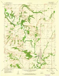
1959 Map of Altoona
USGS Topo · Published 1960About this map
Verdigris River meanders sharply through the heart of Wilson County, anchoring a landscape defined by its river-and-rail economy at the close of the 1950s. The Missouri Pacific railroad corridor tracks the river's path, connecting the primary settlements of Altoona, Benedict, and Guilford. This survey reveals an active industrial footprint integrated into the rural geography, characterized by numerous Oil Wells, Quarries, and Claypits. Local infrastructure and social landmarks are carefully documented, from the Harmony Sch in Chetopa township to Camp Cauble on Crooked Creek. Essential river crossings, including Guilford Bridge and Barnhill Bridge, link the agricultural uplands to the valley floor. The map provides a precise record of the mid-century transition in eastern Kansas, where traditional farming townships like Pleasant Valley and Cedar coexist with persistent mineral extraction and established rail logistics.
Find a feature on this map
24 named features on this map. Tap any name to fly to it.
Don’t see what you’re looking for? This feature index may not catch every label — zoom into the map to look around manually.
Map Details
Editions of this 1959 Altoona Map
3 editions found
Other maps of this area

1886 · Fredonia
USGS Topo · 1:125,000

1886 · Independence
USGS Topo · 1:125,000

1894 · Fredonia
USGS Topo · 1:125,000

1894 · Independence
USGS Topo · 1:125,000

1905 · Independence
USGS Topo · 1:125,000

1938 · Fredonia
USGS Topo · 1:62,500

1938 · Altoona
USGS Topo · 1:62,500

1939 · Altoona
USGS Topo · 1:48,000

1939 · Fredonia
USGS Topo · 1:48,000

1942 · Fredonia
USGS Topo · 1:62,500