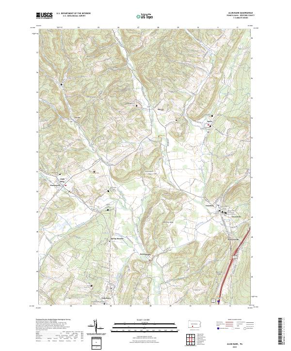
2023 Map of Alum Bank
USGS Topo · Published 2023About this map
Dunning Creek and Bobs Creek carve through the Bedford County landscape, shaping a series of narrow valleys where small settlements like Osterburg and Alum Bank are established. The map reveals a dense concentration of family and community landmarks, particularly evident in the numerous cemeteries that anchor the local geography. From the McDonald Farm Cem in the north to the Fishertown Lutheran Cem in the south, these sites reflect generations of local settlement patterns. Transport through these corridors is facilitated by roads like Lovely Rd and Shellsburg Rd, while the presence of Ickes Airport marks a modern layer upon the traditional agricultural and church-centered communities. Distinctive topographical features such as Harmony Ridge and Black Oak Ridge define the vertical relief, influencing the placement of crossroads like Weyant and St. Clairsville.
Find a feature on this map
138 named features on this map. Tap any name to fly to it.
Don’t see what you’re looking for? This feature index may not catch every label — zoom into the map to look around manually.
Map Details
Editions of this 2023 Alum Bank Map
This is the sole edition of this map. No revisions or reprints were ever made.
Other maps of this area

1900 · Everett
USGS Topo · 1:62,500

1902 · Everett
USGS Topo · 1:62,500

1902 · Ebensburg
USGS Topo · 1:62,500

1902 · Hollidaysburg
USGS Topo · 1:62,500

1903 · Hollidaysburg
USGS Topo · 1:62,500

1904 · Ebensburg
USGS Topo · 1:62,500

1908 · Bedford
USGS Topo · 1:62,500

1910 · Bedford
USGS Topo · 1:62,500

1953 · Pittsburgh
USGS Topo · 1:250,000

1954 · Pittsburgh
USGS Topo · 1:250,000
Featured Places
- Pavia Township, PA
- Saint Clairsville, PA
- Lincoln Township, PA
- West Saint Clair Township, PA
- Kimmel Township, PA