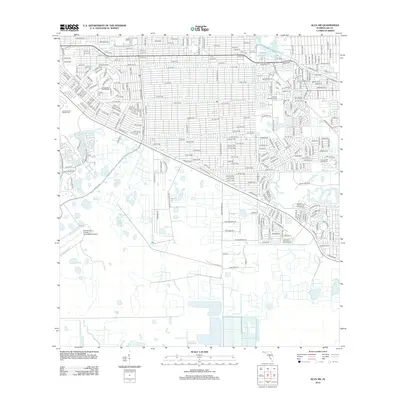
2012 Map of Alva SW
USGS Topo · Published 2012About this map
Lee Memorial Garden Cem and Lehigh Memorial Park anchor the western and central portions of this residential grid, showing the late 20th-century development of the Florida interior. The map illustrates a dense network of suburban streets such as Lee St and Golfview Blvd that contrast with the open, undeveloped tracts to the south. Modern infrastructure is prominent, including the Able Canal and the northern reaches of the Southwest Florida International Airport. Recreation and leisure are central to the neighborhood's layout, with Lauderhills Golf Course and Las Colinas Golf Course integrated into the residential blocks. The land use pattern here is a classic example of Floridian planned community expansion, where drainage canals and organized street grids converted rural acreage into a sprawling residential landscape.
Find a feature on this map
263 named features on this map. Tap any name to fly to it.
Don’t see what you’re looking for? This feature index may not catch every label — zoom into the map to look around manually.
Map Details
Editions of this 2012 Alva SW Map
This is the sole edition of this map. No revisions or reprints were ever made.
Other maps of this area

1956 · West Palm Beach
USGS Topo · 1:250,000

1957 · West Palm Beach
USGS Topo · 1:250,000

1958 · West Palm Beach
USGS Topo · 1:250,000

1958 · Corkscrew NW
USGS Topo · 1:24,000

1958 · Estero
USGS Topo · 1:24,000

1958 · Olga
USGS Topo · 1:24,000

1958 · Alva SW
USGS Topo · 1:24,000

1958 · Fort Myers
USGS Topo · 1:24,000

1958 · Alva
USGS Topo · 1:24,000

1958 · Alva SE
USGS Topo · 1:24,000