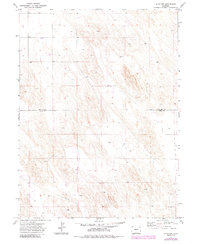
1971 Map of Alvin NW
USGS Topo · Published 1985About this map
The county boundary between Phillips Co and Yuma Co bisects this stretch of high plains, documenting a landscape defined by industrial and agricultural infrastructure in the early 1970s. The terrain is relatively uniform, marked primarily by the presence of a subsurface Pipeline running diagonally through the southern sections. This area of Eastern Colorado shows the systematic development of land for utility and resource management, evidenced by numerous Well sites scattered across the survey. The prominent elevation known as Vogus stands as a rare named topographical marker in an otherwise grid-based landscape of fence lines and section boundaries. The map reflects the period's reliance on groundwater extraction and the transport of energy resources across the prairie, offering a clear record of rural Colorado land use before later twentieth-century developments.
Find a feature on this map
4 named features on this map. Tap any name to fly to it.
Don’t see what you’re looking for? This feature index may not catch every label — zoom into the map to look around manually.
Map Details
Editions of this 1971 Alvin NW Map
3 editions found
Other maps of this area

1954 · Sterling
USGS Topo · 1:250,000

1958 · Sterling
USGS Topo · 1:250,000

1971 · Amherst SW
USGS Topo · 1:24,000

1971 · Holyoke
USGS Topo · 1:24,000

1971 · Alvin NW
USGS Topo · 1:24,000

1971 · Amherst SE
USGS Topo · 1:24,000

1971 · Alvin SW
USGS Topo · 1:24,000

1971 · Wauneta NE
USGS Topo · 1:24,000

1971 · Alvin
USGS Topo · 1:24,000

1971 · Wauneta
USGS Topo · 1:24,000