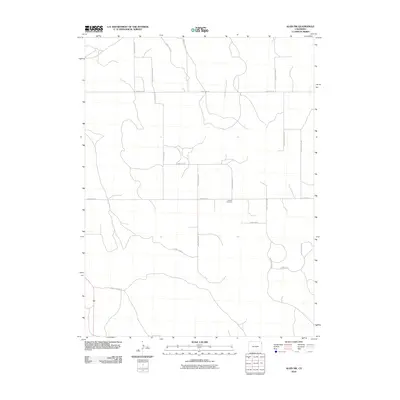
2010 Map of Alvin SW
USGS Topo · Published 2010About this map
Triangle Cemetery sits near the intersection of several section-line roads in this rural stretch of Yuma County. The landscape is defined by an orderly grid of local thoroughfares including County Road 51 and County Road JJ, which facilitate travel through the high plains. The drainage patterns across the terrain appear as subtle, meandering features that break the regularity of the road network, as seen near County Road FF. This 2010 survey reflects the enduring agricultural character of the region, where connectivity is maintained by numbered routes such as County Road 54 and County Road MM. The distribution of these roads indicates a sparse but consistent human presence across the township and range divisions, serving the needs of local ranchers and farmers.
Find a feature on this map
16 named features on this map. Tap any name to fly to it.
Don’t see what you’re looking for? This feature index may not catch every label — zoom into the map to look around manually.
Map Details
Editions of this 2010 Alvin SW Map
This is the sole edition of this map. No revisions or reprints were ever made.
Other maps of this area

1954 · Sterling
USGS Topo · 1:250,000

1958 · Sterling
USGS Topo · 1:250,000

1971 · Alvin NW
USGS Topo · 1:24,000

1971 · Alvin SW
USGS Topo · 1:24,000

1971 · Wauneta NE
USGS Topo · 1:24,000

1971 · Alvin
USGS Topo · 1:24,000

1971 · Wauneta
USGS Topo · 1:24,000

1971 · Wray NE
USGS Topo · 1:24,000

1971 · Eckley NE
USGS Topo · 1:24,000

1971 · Alvin NE
USGS Topo · 1:24,000