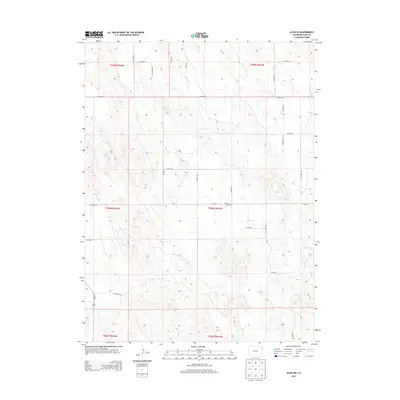
2013 Map of Alvin SW
USGS Topo · Published 2013About this map
Triangle Cem sits near the intersection of Co Road 51 and Co Road LL, serving as a central landmark in this high plains landscape of Yuma County. The map reveals a highly structured grid system of section lines and rural routes, typical of the western Great Plains settlement pattern. Principal transit is anchored by Us-385 N in the southwest corner, while an extensive network of county roads, including Co Road HH and Co Road 55, provides access to the surrounding agricultural tracts. This 2013 survey illustrates the enduring rectilinear organization of the Public Land Survey System, showing how the land remains partitioned into townships such as t004n r043w and t005n r044w. The subtle topographic contours indicate the gentle undulations of the terrain between the established roadway corridors.
Find a feature on this map
24 named features on this map. Tap any name to fly to it.
Don’t see what you’re looking for? This feature index may not catch every label — zoom into the map to look around manually.
Map Details
Editions of this 2013 Alvin SW Map
This is the sole edition of this map. No revisions or reprints were ever made.
Other maps of this area

1954 · Sterling
USGS Topo · 1:250,000

1958 · Sterling
USGS Topo · 1:250,000

1971 · Alvin NW
USGS Topo · 1:24,000

1971 · Alvin SW
USGS Topo · 1:24,000

1971 · Wauneta NE
USGS Topo · 1:24,000

1971 · Alvin
USGS Topo · 1:24,000

1971 · Wauneta
USGS Topo · 1:24,000

1971 · Wray NE
USGS Topo · 1:24,000

1971 · Eckley NE
USGS Topo · 1:24,000

1971 · Alvin NE
USGS Topo · 1:24,000