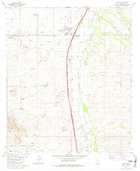
1981 Map of Amado
USGS Topo · Published 1981About this map
Arivaca Junction and the settlement of Amado serve as the primary hubs along the Interstate 19 corridor in this southern Arizona desert landscape. The map illustrates a transition from the riparian environment of the Santa Cruz River to the arid slopes of the Tumacacori Mountains. Ranching heritage is prominent throughout the quadrangle, evidenced by the Sopori Ranch, Pina Sopori Ranch, and Rex Ranch, alongside several Corral and Water Tank sites. The local infrastructure of the early 1980s includes the Southern Pacific railroad line, a small Landing Strip, and community landmarks such as the Sopori Sch and Greyhound Park. The southwestern portion of the sheet is defined by the Coronado National Forest and a designated U.S. Military Reservation, while the northern boundary touches the historic San Ignacio De La Canoa land grant.
Find a feature on this map
50 named features on this map. Tap any name to fly to it.
Don’t see what you’re looking for? This feature index may not catch every label — zoom into the map to look around manually.
Map Details
Editions of this 1981 Amado Map
2 editions found
Other maps of this area

1904 · Patagonia
USGS Topo · 1:125,000

1905 · Patagonia
USGS Topo · 1:125,000

1920 · Arivaca
USGS Topo · 1:125,000

1922 · Agus Caliente
USGS Topo · 1:62,500

1925 · Samaniego Peak
USGS Topo · 1:62,500

1926 · Helvetia
USGS Topo · 1:62,500

1939 · Twin Buttes
USGS Topo · 1:62,500

1939 · Tubac
USGS Topo · 1:62,500

1941 · Twin Buttes
USGS Topo · 1:62,500

1943 · Tubac
USGS Topo · 1:62,500