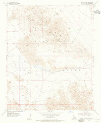
1954 Map of Amboy Crater
USGS Topo · Published 1961About this map
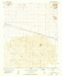
Amboy Crater dominates this Mojave Desert landscape, surrounded by extensive volcanic fields designated simply as Lava. The mid-century topography reveals the industrial and transportation corridor of the Atchison Topeka and Santa Fe railroad, which parallels the iconic Route 66 through the northern half of the sheet. At the small settlement of Bagdad, a lonely Cemetery and a few buildings sit near the tracks, while a Landing Field to the east provides a critical waypoint for desert travelers. The southern portion of the quadrangle is largely occupied by the Marine Corps Training Center, demonstrating the region's military significance. Between the Lava Hills and the Bristol Mountains, scattered evidence of mineral extraction appears in the form of a Mine and a Prospect, while the southern edge touches the salt flats of Bristol Lake.
Find a feature on this map
14 named features on this map. Tap any name to fly to it.
Don’t see what you’re looking for? This feature index may not catch every label — zoom into the map to look around manually.
Map Details
Editions of this 1954 Amboy Crater Map
3 editions found

Other maps of this area

1942 · Amboy
USGS Topo · 1:250,000

1943 · Amboy
USGS Topo · 1:250,000

1954 · Needles
USGS Topo · 1:250,000
1954 · Bristol Lake NW
USGS Topo · 1:24,000
1954 · Amboy Crater
USGS Topo · 1:24,000
1954 · Bagdad SW
USGS Topo · 1:24,000
1955 · Lead Mountain
USGS Topo · 1:24,000
1955 · Lead Mtn. NE
USGS Topo · 1:24,000
1955 · Lead Mountain
USGS Topo · 1:62,500

1956 · Needles
USGS Topo · 1:250,000