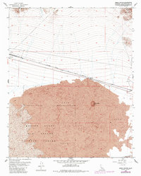
1954 Map of Amboy Crater
USGS Topo · Published 1985About this map
Amboy Crater dominates the southern landscape of this mid-century survey, surrounded by an expansive field of Lava that pushes toward the edges of Bristol Lake. The northern half of the map is defined by the sharp transition from the Lava Hills and Bristol Mountains down to the rail corridor. The Atchison Topeka and Santa Fe railroad serves as the primary artery through the desert, passing the settlement of Bagdad and its associated Cemetery. This area illustrates the stark desert geography where industrial extraction and military presence meet, as seen in the boundary of the Marine Corps Air Ground Combat Center. Small-scale operations are indicated by a Mine and Pit scattered near the foothills, while a Landing Field near the eastern margin suggests the reliance on aerial access in this isolated Mojave corridor during the post-war years.
Find a feature on this map
15 named features on this map. Tap any name to fly to it.
Don’t see what you’re looking for? This feature index may not catch every label — zoom into the map to look around manually.
Map Details
Editions of this 1954 Amboy Crater Map
3 editions found
Other maps of this area

1942 · Amboy
USGS Topo · 1:250,000

1943 · Amboy
USGS Topo · 1:250,000

1954 · Needles
USGS Topo · 1:250,000

1954 · Bristol Lake NW
USGS Topo · 1:24,000

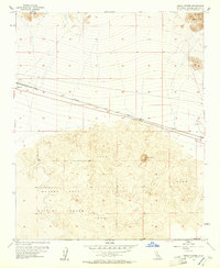
1954 · Amboy Crater
USGS Topo · 1:24,000

1954 · Bagdad SW
USGS Topo · 1:24,000

1955 · Lead Mountain
USGS Topo · 1:24,000

1955 · Lead Mtn. NE
USGS Topo · 1:24,000

1955 · Lead Mountain
USGS Topo · 1:62,500

1956 · Needles
USGS Topo · 1:250,000