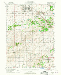
1951 Map of Amboy
USGS Topo · Published 1967About this map
Green River Ordnance Plant occupies a significant portion of this Lee County landscape, marking the industrial and military footprint in the region shortly after the mid-century. This survey captures a rural network of small agricultural settlements like Lee Center, Binghampton, and Van Orin connected by the Chicago Burlington and Quincy and Illinois Central railroads. The map provides extensive detail for genealogists, showing dozens of country schools such as Pleasant Valley Sch and Basswood Corner Sch, many of which were likely nearing consolidation at this time.
Find a feature on this map
52 named features on this map. Tap any name to fly to it.
Don’t see what you’re looking for? This feature index may not catch every label — zoom into the map to look around manually.
Map Details
Editions of this 1951 Amboy Map
3 editions found

Other maps of this area

1893 · Hennepin
USGS Topo · 1:62,500

1893 · Lasalle
USGS Topo · 1:62,500

1909 · Hennepin
USGS Topo · 1:62,500

1911 · La Salle
USGS Topo · 1:62,500

1911 · Hennepin
USGS Topo · 1:62,500

1913 · La Salle
USGS Topo · 1:62,500

1918 · Dixon
USGS Topo · 1:62,500

1921 · Buda
USGS Topo · 1:62,500

1923 · Buda
USGS Topo · 1:62,500

1930 · Woodsung
USGS Topo · 1:48,000