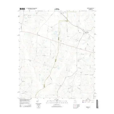
2014 Map of Ambrose
USGS Topo · Published 2014About this map
Ambrose and Wray anchor this agricultural landscape in Coffee and Irwin counties, where the boundary line follows the Irwin Co Coffee Co border. The terrain is defined by a dense network of blackwater drainages including the Satilla River, Seventeen Mile River, and numerous smaller branches like Sand Hill Br and Bee Gum Br. Genealogists will find several burial grounds across the rural landscape, including New Hope Cem, Satilla Cem, and Paulk Cem, often located near crossroads or historical homesteads.
Find a feature on this map
90 named features on this map. Tap any name to fly to it.
Don’t see what you’re looking for? This feature index may not catch every label — zoom into the map to look around manually.
Map Details
Editions of this 2014 Ambrose Map
This is the sole edition of this map. No revisions or reprints were ever made.
Other maps of this area

1953 · Waycross
USGS Topo · 1:250,000

1958 · Waycross
USGS Topo · 1:250,000

1972 · Broxton North
USGS Topo · 1:24,000

1972 · Fitzgerald East
USGS Topo · 1:24,000

1972 · Lax
USGS Topo · 1:24,000

1972 · Ambrose
USGS Topo · 1:24,000

1972 · Ocilla East
USGS Topo · 1:24,000

1972 · Mora
USGS Topo · 1:24,000

1977 · Osierfield
USGS Topo · 1:24,000
1977 · Mora
USGS Topo · 1:24,000