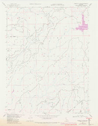
1948 Map of American House
USGS Topo · Published 1978About this map
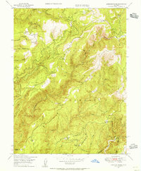
Mooreville Ridge and Harrison Ridge dominate this section of the Plumas National Forest, where steep canyons are carved by the Middle Fork Feather River and South Fork Feather River. The settlement pattern centers on remote mountain outposts and industrial sites, including the American House locality and the family-owned McIntosh Ranch and Boehme Ranch. A mid-century infrastructure shift is visible in the presence of the Little Grass Valley Res, which sits near the headwaters of the South Fork Feather River. Mining history is preserved through labels for the Browns Hill Mine and Sanborn Mine, while the high peaks are punctuated by fire detection sites such as Camel Pk Lookout and Lexington Hill Lookout. This landscape reflects the transition from early gold-seeking ventures to modern water resource management and forest service oversight.
Find a feature on this map
47 named features on this map. Tap any name to fly to it.
Don’t see what you’re looking for? This feature index may not catch every label — zoom into the map to look around manually.
Map Details
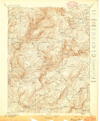
Editions of this 1948 American House Map
3 editions found

Other maps of this area

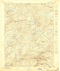
1888 · Bidwell Bar
USGS Topo · 1:125,000

1891 · Bidwell Bar
USGS Topo · 1:125,000

1891 · Downieville
USGS Topo · 1:125,000

1893 · Bidwell Bar
USGS Topo · 1:125,000

1893 · Downieville
USGS Topo · 1:125,000

1895 · Bidwell Bar
USGS Topo · 1:125,000

1895 · Downieville
USGS Topo · 1:125,000

1896 · Downieville
USGS Topo · 1:125,000
1897 · Bidwell Bar
USGS Topo · 1:125,000
1897 · Downieville
USGS Topo · 1:125,000