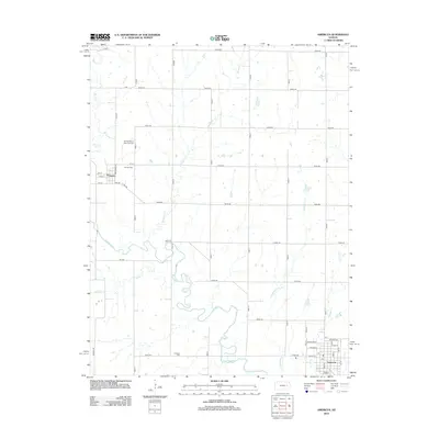
2012 Map of Americus
USGS Topo · Published 2012About this map
The Neosho River meanders broadly across this portion of Lyon County, defining a landscape shaped by its winding course and several significant tributaries including Kahola Cr and Troublesome Cr. The town of Americus sits at the southeastern corner of the quadrangle, organized by a street grid that includes Sycamore St and Hickory St near the local Po. To the northwest, the smaller settlement of Dunlap serves as a focal point for local history, notably featuring the Dunlap African American Cem. This site, along with Dunlap Cem and the more southern Fruitland Cem, provides essential points of reference for genealogists and local historians tracking the area's rural heritage. The map documents a rigid section-line road network, such as Road A and Road 240, which overlays the fluid paths of Wrights Cr and Pester Cr.
Find a feature on this map
50 named features on this map. Tap any name to fly to it.
Don’t see what you’re looking for? This feature index may not catch every label — zoom into the map to look around manually.
Map Details
Editions of this 2012 Americus Map
This is the sole edition of this map. No revisions or reprints were ever made.
Other maps of this area

1885 · Eskridge
USGS Topo · 1:125,000

1888 · Emporia
USGS Topo · 1:125,000

1889 · Eskridge
USGS Topo · 1:125,000

1894 · Emporia
USGS Topo · 1:125,000

1894 · Eskridge
USGS Topo · 1:125,000

1955 · Hutchinson
USGS Topo · 1:250,000

1957 · Emporia
USGS Topo · 1:24,000

1957 · Saffordville
USGS Topo · 1:24,000

1957 · Plymouth
USGS Topo · 1:24,000

1959 · Hutchinson
USGS Topo · 1:250,000