2022 Map of Americus
USGS Topo · Published 2022About this map
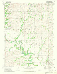
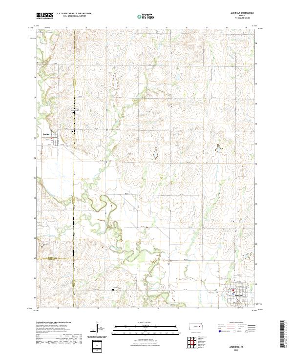
Americus and the surrounding Lyon County countryside are defined by the meandering course of the Neosho River and its various tributaries. This modern survey illustrates the persistent agricultural and settlement patterns of the region, where township roads like Rd 240 and Rd 320 form a precise grid across the undulating terrain. Significant genealogical sites are documented, including the Dunlap African American Cem and Dunlap Cem near the town of Dunlap, alongside the more remote Fruitland Cem to the south. The hydrography of the area is particularly detailed, tracing the winding paths of Kahola Cr, Wrights Cr, and Troublesome Cr as they feed into the river system. In the town of Americus, the residential grid is fully named, featuring streets such as Broadway St and Hackberry St.
Find a feature on this map
46 named features on this map. Tap any name to fly to it.
Don’t see what you’re looking for? This feature index may not catch every label — zoom into the map to look around manually.
Map Details
Editions of this 2022 Americus Map
This is the sole edition of this map. No revisions or reprints were ever made.