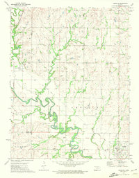
1972 Map of Americus
USGS Topo · Published 1974About this map
Neosho River meanders across this central Kansas landscape, where the intersection of Lyon, Morris, and Chase counties meets the historical Old Indian Treaty Boundary. The settlement of Americus sits in the southeast, while Dunlap anchors the northwest corner along the Missouri Pacific tracks. This 1970s survey captures a transition in transportation, showing both active rail lines and the Old Railroad Grade winding through the terrain near Wrights Creek. Genealogists will find significant value in the distribution of local burial grounds, including Sunnyside Cem, Dunlap Cem, and Fruitland Cem. The map provides a clear record of the rural landscape before further modernization, from the Gravel Pits in Agnes City to the various creek systems like Rock Creek, Kahola Creek, and Troublesome Creek that define the local drainage patterns.
Find a feature on this map
22 named features on this map. Tap any name to fly to it.
Don’t see what you’re looking for? This feature index may not catch every label — zoom into the map to look around manually.
Map Details
Editions of this 1972 Americus Map
This is the sole edition of this map. No revisions or reprints were ever made.
Other maps of this area

1885 · Eskridge
USGS Topo · 1:125,000

1888 · Emporia
USGS Topo · 1:125,000

1889 · Eskridge
USGS Topo · 1:125,000

1894 · Emporia
USGS Topo · 1:125,000

1894 · Eskridge
USGS Topo · 1:125,000

1955 · Hutchinson
USGS Topo · 1:250,000

1957 · Emporia
USGS Topo · 1:24,000

1957 · Saffordville
USGS Topo · 1:24,000

1957 · Plymouth
USGS Topo · 1:24,000

1959 · Hutchinson
USGS Topo · 1:250,000