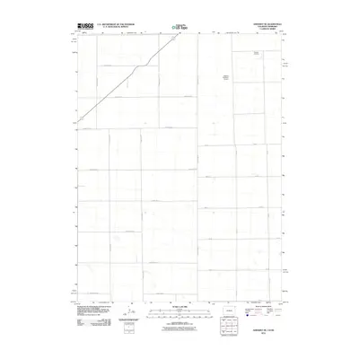
2010 Map of Amherst NE
USGS Topo · Published 2010About this map
Venango Cemetery sits at the northern edge of this agricultural landscape along the Colorado-Nebraska border, serving as a primary local landmark for genealogical interest. The terrain is defined by a rigid grid of rural infrastructure, including County Rd-42 and County Rd-40, which facilitate movement through the high plains. A notable aviation feature, the Dodson Brothers Airport, is situated in the northeastern portion of the quadrangle, reflecting the importance of private air travel in these sparsely populated farming regions. The land is intermittently dotted with small depressions and seasonal water features, characteristic of the High Plains drainage patterns that influence the placement of thoroughfares like 312 Ave and 750 Rd.
Find a feature on this map
23 named features on this map. Tap any name to fly to it.
Don’t see what you’re looking for? This feature index may not catch every label — zoom into the map to look around manually.
Map Details
Editions of this 2010 Amherst NE Map
This is the sole edition of this map. No revisions or reprints were ever made.
Other maps of this area

1954 · Sterling
USGS Topo · 1:250,000

1954 · McCook
USGS Topo · 1:250,000

1957 · McCook
USGS Topo · 1:250,000

1958 · McCook
USGS Topo · 1:250,000

1958 · Sterling
USGS Topo · 1:250,000

1961 · Lamar
USGS Topo · 1:24,000

1961 · Lamar NW
USGS Topo · 1:24,000

1961 · Brandon
USGS Topo · 1:24,000

1962 · Venango SW
USGS Topo · 1:24,000

1962 · Amherst
USGS Topo · 1:24,000