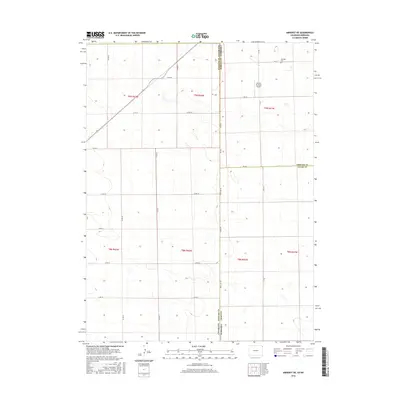
2016 Map of Amherst NE
USGS Topo · Published 2016About this map
The high plains of the Colorado and Nebraska border take center stage in this 2016 survey, where the landscape is defined by the rigid geometry of the Public Land Survey System and the interstate boundary. State Line Rd serves as the literal divide between Phillips County, Colorado, and Perkins and Chase counties in Nebraska. The region's agricultural and aviation history is evidenced by the Dodson Brothers Airport in Nebraska, while the Venango Cem near the northern edge provides a point of interest for genealogists tracing local families. The map illustrates a sparse but functional network of section-line roads, such as Co Rd 42 and Co Rd 57, which navigate the subtle topography of this prairie region where small depressions and drainage patterns break the otherwise uniform grid of T9N and T8N townships.
Find a feature on this map
29 named features on this map. Tap any name to fly to it.
Don’t see what you’re looking for? This feature index may not catch every label — zoom into the map to look around manually.
Map Details
Editions of this 2016 Amherst NE Map
This is the sole edition of this map. No revisions or reprints were ever made.
Other maps of this area

1954 · Sterling
USGS Topo · 1:250,000

1954 · McCook
USGS Topo · 1:250,000

1957 · McCook
USGS Topo · 1:250,000

1958 · McCook
USGS Topo · 1:250,000

1958 · Sterling
USGS Topo · 1:250,000

1961 · Lamar
USGS Topo · 1:24,000

1961 · Lamar NW
USGS Topo · 1:24,000

1961 · Brandon
USGS Topo · 1:24,000

1962 · Venango SW
USGS Topo · 1:24,000

1962 · Amherst
USGS Topo · 1:24,000