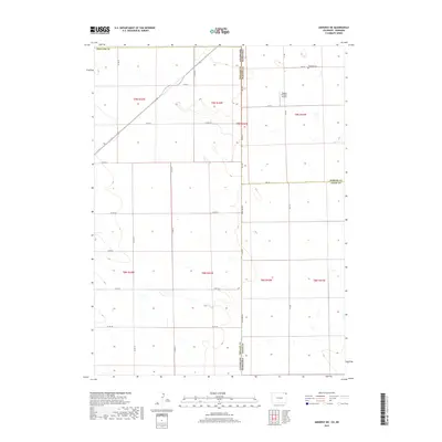
2019 Map of Amherst NE
USGS Topo · Published 2019About this map
State Line Rd serves as the literal and figurative spine of this survey, marking the straight-edged boundary between Colorado and Nebraska. On the Nebraska side, the landscape is defined by the section-line grid of Perkins and Chase counties, where Venango Cem and Dodson Brothers Airport sit as isolated landmarks of local infrastructure. The Colorado portion in Phillips Co shows a similar high-plains agricultural pattern, though the road network, including Co Rd 40 and Co Rd 57, occasionally bends to accommodate the subtle natural drainages that break the otherwise rigid township and range system. This 2019 data reveals a landscape of massive circular irrigation fields and rural section roads, illustrating the enduring scale of modern dryland and irrigated farming at the state border.
Find a feature on this map
30 named features on this map. Tap any name to fly to it.
Don’t see what you’re looking for? This feature index may not catch every label — zoom into the map to look around manually.
Map Details
Editions of this 2019 Amherst NE Map
This is the sole edition of this map. No revisions or reprints were ever made.
Other maps of this area

1954 · Sterling
USGS Topo · 1:250,000

1954 · McCook
USGS Topo · 1:250,000

1957 · McCook
USGS Topo · 1:250,000

1958 · McCook
USGS Topo · 1:250,000

1958 · Sterling
USGS Topo · 1:250,000

1961 · Lamar
USGS Topo · 1:24,000

1961 · Lamar NW
USGS Topo · 1:24,000

1961 · Brandon
USGS Topo · 1:24,000

1962 · Venango SW
USGS Topo · 1:24,000

1962 · Amherst
USGS Topo · 1:24,000