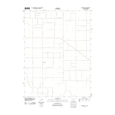
2010 Map of Amherst SE
USGS Topo · Published 2010About this map
Frenchman Creek and Wildhorse Creek cut through this corner of Chase County, defining the drainage patterns of an otherwise strictly organized agricultural landscape. The region is marked by a rigorous section-line road network, including north-south corridors like County Rd 61 and 312 Ave, and east-west routes such as 742 Rd. This layout reveals the enduring influence of the Public Land Survey System on Nebraska's high plains, where large-scale farming dominates the terrain. Centrally located within this grid is the Pleasant Valley Cemetery, a significant landmark for genealogical research that indicates the historical presence of a local rural community. The map illustrates the subtle interplay between the natural meanders of the creeks and the human-imposed geometry of the county road system during the early 21st century.
Find a feature on this map
29 named features on this map. Tap any name to fly to it.
Don’t see what you’re looking for? This feature index may not catch every label — zoom into the map to look around manually.
Map Details
Editions of this 2010 Amherst SE Map
This is the sole edition of this map. No revisions or reprints were ever made.
Other maps of this area

1954 · Sterling
USGS Topo · 1:250,000

1954 · McCook
USGS Topo · 1:250,000

1957 · McCook
USGS Topo · 1:250,000

1958 · McCook
USGS Topo · 1:250,000

1958 · Sterling
USGS Topo · 1:250,000

1961 · Lamar
USGS Topo · 1:24,000

1961 · Lamar NW
USGS Topo · 1:24,000

1962 · Amherst
USGS Topo · 1:24,000

1962 · Amherst NE
USGS Topo · 1:24,000

1971 · Amherst SW
USGS Topo · 1:24,000