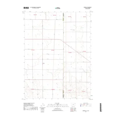
2019 Map of Amherst SE
USGS Topo · Published 2019About this map
The High Plains landscape of the Colorado and Nebraska border comes into focus along the drainage of Frenchman Cr and Sand Draw. This agricultural region is defined by a rigid grid of county roads, including Co RD 26 and Co RD 14, which partition the large tracts of land characteristic of the area's farming and ranching economy. A key genealogical point of interest is the Pleasant Valley Cem, located near the center of the map, serving as a quiet marker of the community's heritage amidst the expansive fields. The terrain is marked by the intermittent paths of Wildhorse Cr and other seasonal waterways that shape the contours of the land in this corner of Chase County.
Find a feature on this map
27 named features on this map. Tap any name to fly to it.
Don’t see what you’re looking for? This feature index may not catch every label — zoom into the map to look around manually.
Map Details
Editions of this 2019 Amherst SE Map
This is the sole edition of this map. No revisions or reprints were ever made.
Other maps of this area

1954 · Sterling
USGS Topo · 1:250,000

1954 · McCook
USGS Topo · 1:250,000

1957 · McCook
USGS Topo · 1:250,000

1958 · McCook
USGS Topo · 1:250,000

1958 · Sterling
USGS Topo · 1:250,000

1961 · Lamar
USGS Topo · 1:24,000

1961 · Lamar NW
USGS Topo · 1:24,000

1962 · Amherst
USGS Topo · 1:24,000

1962 · Amherst NE
USGS Topo · 1:24,000

1971 · Amherst SW
USGS Topo · 1:24,000