
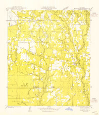
1949 Map of Amite
USGS Topo · Published 1949About this map
Amite stands as a primary hub of development along the Illinois Central railroad in this 1940s landscape, which spans the boundaries of St. Helena, Tangipahoa, and Livingston parishes. The area is defined by a dense network of rural infrastructure, featuring numerous community-specific landmarks such as Ott School, Harris School, and the Woods School. Religious and memorial sites are frequent, including Higgs Church, Columbia Church, and the Durbin Cemetery. The land is drained by the Natalbany River and the Little Natalbany River, which meander through a grid of section lines. This survey captures a specific moment in Louisiana's parish history, illustrating how small settlements like Gullett and Hillsdale were linked by both the rail corridor and growing state highways.
Find a feature on this map
39 named features on this map. Tap any name to fly to it.
Don’t see what you’re looking for? This feature index may not catch every label — zoom into the map to look around manually.
Map Details
Editions of this 1949 Amite Map
This is the sole edition of this map. No revisions or reprints were ever made.
Other maps of this area

1940 · Tickfaw
USGS Topo · 1:31,680

1940 · Roseland
USGS Topo · 1:31,680

1942 · Roseland
USGS Topo · 1:31,680

1942 · Montpelier
USGS Topo · 1:31,680

1942 · Loranger
USGS Topo · 1:31,680

1949 · Bolivar
USGS Topo · 1:31,680

1949 · Albany
USGS Topo · 1:31,680

1950 · Doyle
USGS Topo · 1:31,680

1950 · Greensburg
USGS Topo · 1:31,680
1954 · Montpelier
USGS Topo · 1:31,680