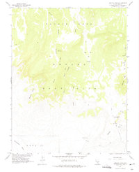
1961 Map of Ammonia Tanks
USGS Topo · Published 1975About this map
Nevada Test Site operations define this high-altitude landscape during the early 1960s, a period when the Area 18 sector was being mapped for nuclear research. The terrain is characterized by massive volcanic landforms including the southern edge of Pahute Mesa and the flat expanse of Buckboard Mesa. Significant topographical markers like Blacktop Buttes and Rattlesnake Ridge stand over a network of canyons and ridges, including Silent Canyon, Split Canyon, and Split Ridge. The presence of the Ammonia Tanks and Stockade Road indicates the early infrastructure developed for the Atomic Energy Commission. Beyond the testing grounds, the map documents natural landmarks such as Landmark Rock and Big Burn Valley, alongside isolated Cave sites. This survey, compiled from 1959 aerial photography and 1961 field checks, provides a technical view of a high-security government range at the height of the Cold War.
Find a feature on this map
17 named features on this map. Tap any name to fly to it.
Don’t see what you’re looking for? This feature index may not catch every label — zoom into the map to look around manually.
Map Details
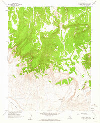
Editions of this 1961 Ammonia Tanks Map
2 editions found
Other maps of this area

1908 · Kawich
USGS Topo · 1:250,000

1942 · Wheelbarrow Peak
USGS Topo · 1:125,000

1952 · Tippipah Spring
USGS Topo · 1:62,500

1952 · Timber Mountain
USGS Topo · 1:62,500

1952 · Wheelbarrow Peak
USGS Topo · 1:62,500

1952 · Silent Canyon
USGS Topo · 1:62,500

1954 · Goldfield
USGS Topo · 1:250,000

1955 · Goldfield
USGS Topo · 1:250,000

1958 · Goldfield
USGS Topo · 1:250,000
1960 · Tippipah Spring
USGS Topo · 1:24,000