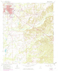
1966 Map of Amory
USGS Topo · Published 1982About this map
Amory serves as a significant rail and municipal hub in this 1960s study, updated in the early 1980s to show urban expansion. The town's grid is defined by the Mississippian and Burlington Northern railroads, which meet near the commercial core. Significant local infrastructure includes the Amory High Sch and Gilmore Hospital, alongside industrial markers like the railroad roundhouse and a nearby substation.
Find a feature on this map
52 named features on this map. Tap any name to fly to it.
Don’t see what you’re looking for? This feature index may not catch every label — zoom into the map to look around manually.
Map Details
Editions of this 1966 Amory Map
3 editions found
Other maps of this area

1953 · West Point
USGS Topo · 1:250,000

1956 · Tupelo
USGS Topo · 1:250,000

1958 · Tupelo
USGS Topo · 1:250,000

1958 · West Point
USGS Topo · 1:250,000

1963 · West Point
USGS Topo · 1:250,000

1966 · Smithville
USGS Topo · 1:24,000

1966 · Aberdeen
USGS Topo · 1:24,000

1966 · Amory
USGS Topo · 1:24,000

1966 · Amory SW
USGS Topo · 1:24,000

1966 · Turon
USGS Topo · 1:24,000