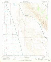
1956 Map of Amos
USGS Topo · Published 1968About this map
Amos sits at the junction of the Southern Pacific railroad and the desert edge during the mid-1950s. This landscape reveals the complex water infrastructure required to sustain the Imperial Valley, where the Coachella Canal and East Highline Canal border the transition from the arid Sand Hills to the fertile agricultural grid. The map documents an extensive network of irrigation features, including the Vail Supply Canal and numerous named laterals and drains like Nectarine Lateral and Mulberry Drain. To the east, the Naval Reservation occupies the open terrain of the East Mesa, marked by military infrastructure such as Target 95 and a Rake Tower. The presence of the Hogue settlement and various Gravel Pits reflects the local economy centered on transportation, desert reclamation, and resource extraction during this era of post-war development.
Find a feature on this map
59 named features on this map. Tap any name to fly to it.
Don’t see what you’re looking for? This feature index may not catch every label — zoom into the map to look around manually.
Map Details
Editions of this 1956 Amos Map
4 editions found
Other maps of this area

1907 · Holtville
USGS Topo · 1:125,000

1940 · Iris
USGS Topo · 1:62,500

1940 · Alamorio
USGS Topo · 1:62,500

1942 · El Centro
USGS Topo · 1:250,000

1945 · Alamorio
USGS Topo · 1:62,500

1945 · Iris
USGS Topo · 1:62,500

1953 · Acolita
USGS Topo · 1:24,000

1953 · Acolita
USGS Topo · 1:62,500

1954 · El Centro
USGS Topo · 1:250,000

1954 · Salton Sea
USGS Topo · 1:250,000