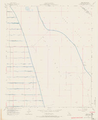
1956 Map of Amos
USGS Topo · Published 1968About this map
Amos sits at the edge of the Sand Hills in Imperial County, a small stop along the Southern Pacific railroad line. This desert landscape is defined by the massive irrigation infrastructure necessary for the Imperial Valley, with the East Highline Canal and the Coachella Levee cutting through the arid terrain. The map reveals an intricate network of lateral drains and canals, such as the Vail Supply Canal and Mulberry Drain, that deliver water to the mesa's edge. A significant portion of the eastern landscape is dedicated to a Naval Reservation, which contains specialized military landmarks including Target 95 and a Rake Tower. Genealogists and local historians can locate the Amos Cem near the railroad tracks, while several gaging stations and a Gravel Pit indicate the ongoing engineering and industrial activity of the mid-1950s.
Find a feature on this map
50 named features on this map. Tap any name to fly to it.
Don’t see what you’re looking for? This feature index may not catch every label — zoom into the map to look around manually.
Map Details
Editions of this 1956 Amos Map
4 editions found
Other maps of this area

1907 · Holtville
USGS Topo · 1:125,000

1940 · Iris
USGS Topo · 1:62,500

1940 · Alamorio
USGS Topo · 1:62,500

1942 · El Centro
USGS Topo · 1:250,000

1945 · Alamorio
USGS Topo · 1:62,500

1945 · Iris
USGS Topo · 1:62,500

1953 · Acolita
USGS Topo · 1:24,000

1953 · Acolita
USGS Topo · 1:62,500

1954 · El Centro
USGS Topo · 1:250,000

1954 · Salton Sea
USGS Topo · 1:250,000