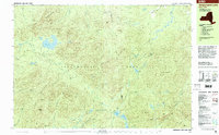
1999 Map of Ampersand Lake
USGS Topo · Published 2001About this map
Adirondack Park dominates this terrain, where the High Peaks and complex water systems of the Ampersand Mountains and Seward Mountains meet. The landscape is defined by its lack of modern infrastructure, with the notable exception of Averyville Road in the north and the long-distance Northville Placid Trail winding through the interior. This map provides a look at the wilderness at the close of the millennium, showing the hydrological connections between Ampersand Lake, the Chubb River, and the Cold Brook drainage.
Find a feature on this map
57 named features on this map. Tap any name to fly to it.
Don’t see what you’re looking for? This feature index may not catch every label — zoom into the map to look around manually.
Map Details
Editions of this 1999 Ampersand Lake Map
This is the sole edition of this map. No revisions or reprints were ever made.
Other maps of this area

1895 · Mt. Marcy
USGS Topo · 1:62,500

1896 · Lake Placid
USGS Topo · 1:62,500

1898 · Lake Placid
USGS Topo · 1:62,500

1902 · Mt. Marcy
USGS Topo · 1:62,500

1902 · Saranac
USGS Topo · 1:62,500

1904 · Saranac
USGS Topo · 1:62,500

1904 · Santanoni
USGS Topo · 1:62,500

1904 · Long Lake
USGS Topo · 1:62,500

1905 · Saint Regis
USGS Topo · 1:62,500

1948 · Ogdensburg
USGS Topo · 1:250,000