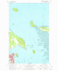
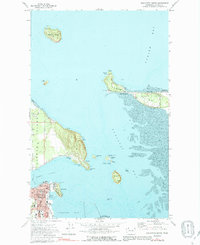
1973 Map of Anacortes North
USGS Topo · Published 1977About this map
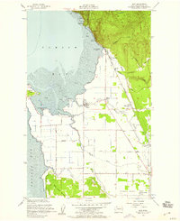
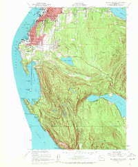
Guemes Island and the northern waterfront of Anacortes anchor this coastal survey, where the terrestrial landscape is defined by the complex interface of Padilla Bay and Samish Bay. This environment is shaped by extensive Tidal Flats and specialized land use, including the Camp Kirby facility and several protected natural areas such as the San Juan Islands Nat Wildlife Refuge. The map reveals a mix of recreational and industrial activity, from Saddlebag Island State Park to the Burlington Northern rail line and the March Point Light. Local history is preserved in features like Eden Cem on the western shore of Guemes Island and the Island View Sch further south. The proximity of Cap Sante and its namesake park to the urban grid of Anacortes provides a detailed look at the 1970s development of this maritime hub.
Find a feature on this map
43 named features on this map. Tap any name to fly to it.
Don’t see what you’re looking for? This feature index may not catch every label — zoom into the map to look around manually.
Map Details
Editions of this 1973 Anacortes North Map
3 editions found

Other maps of this area

1911 · Mount Vernon
USGS Topo · 1:125,000

1918 · Samish Lake
USGS Topo · 1:62,500

1940 · Mt Vernon
USGS Topo · 1:62,500

1943 · Mt Vernon
USGS Topo · 1:62,500

1943 · Deception Pass
USGS Topo · 1:62,500

1943 · Anacortes
USGS Topo · 1:62,500

1951 · Deception Pass
USGS Topo · 1:62,500

1951 · Anacortes
USGS Topo · 1:62,500
1954 · Bow
USGS Topo · 1:24,000
1954 · Bellingham South
USGS Topo · 1:24,000