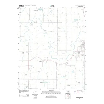
2009 Map of Anadarko West
USGS Topo · Published 2009About this map
The Washita River meanders across this Caddo County landscape, defining the character of the river valley west of Anadarko. In the early 2000s, the region was heavily shaped by water management and power infrastructure, seen in the numerous flood control structures like the Fort Cobb Laterals Site 13 Reservoir and the Southwestern Power Station Number 3 Dam. These engineering projects stand alongside older cultural landmarks, including the Nazarene Camp and Holiness Camp near the river. For genealogists and local historians, the map provides precise locations for several burial grounds, such as Memory Lane Cemetery on the edge of town, and more remote sites like Red Stone Cemetery and Ware Cemetery, which are surrounded by the section-line grid of rural roads like Squaretop Rd.
Find a feature on this map
55 named features on this map. Tap any name to fly to it.
Don’t see what you’re looking for? This feature index may not catch every label — zoom into the map to look around manually.
Map Details
Editions of this 2009 Anadarko West Map
This is the sole edition of this map. No revisions or reprints were ever made.
Other maps of this area

1945 · Anadarko
USGS Topo · 1:62,500

1949 · Cement
USGS Topo · 1:62,500

1951 · Fort Cobb
USGS Topo · 1:62,500

1955 · Lawton
USGS Topo · 1:250,000

1955 · Clinton
USGS Topo · 1:250,000

1956 · Boone
USGS Topo · 1:24,000
1956 · Cyril
USGS Topo · 1:24,000

1956 · Apache
USGS Topo · 1:24,000

1956 · Apache
USGS Topo · 1:62,500
1956 · Cement
USGS Topo · 1:62,500