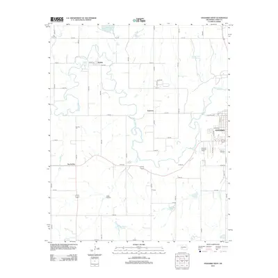
2012 Map of Anadarko West
USGS Topo · Published 2012About this map
The Washita River meanders sharply across this Caddo County landscape, defining the topography west of Anadarko. The settlement pattern is anchored by small communities and junctions such as Washita, Squaretop, and Apache Wye, reflecting the rural Oklahoma distribution of the early 21st century. For genealogists and local historians, the sheet is particularly valuable for its precise location of several burial grounds, including Memory Lane Cem on the edge of town, Red Stone Cem, Ware Cem, and Rest Haven Cem near the northern boundary.
Find a feature on this map
52 named features on this map. Tap any name to fly to it.
Don’t see what you’re looking for? This feature index may not catch every label — zoom into the map to look around manually.
Map Details
Editions of this 2012 Anadarko West Map
This is the sole edition of this map. No revisions or reprints were ever made.
Other maps of this area

1945 · Anadarko
USGS Topo · 1:62,500

1949 · Cement
USGS Topo · 1:62,500

1951 · Fort Cobb
USGS Topo · 1:62,500

1955 · Lawton
USGS Topo · 1:250,000

1955 · Clinton
USGS Topo · 1:250,000

1956 · Boone
USGS Topo · 1:24,000
1956 · Cyril
USGS Topo · 1:24,000

1956 · Apache
USGS Topo · 1:24,000

1956 · Apache
USGS Topo · 1:62,500
1956 · Cement
USGS Topo · 1:62,500