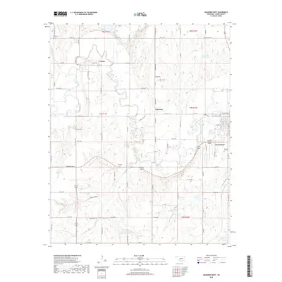
2018 Map of Anadarko West
USGS Topo · Published 2018About this map
The Washita River meanders across this Caddo County landscape, defining the topography of the western outskirts of Anadarko. In this decade, the area is characterized by a network of rural county roads connecting small settlements like Washita and Squaretop with the larger municipal hub to the east. The map records several important local landmarks for genealogical research, including Memory Lane Cem near the city and the more remote Red Stone Cem and Ware Cem.
Find a feature on this map
46 named features on this map. Tap any name to fly to it.
Don’t see what you’re looking for? This feature index may not catch every label — zoom into the map to look around manually.
Map Details
Editions of this 2018 Anadarko West Map
This is the sole edition of this map. No revisions or reprints were ever made.
Other maps of this area

1945 · Anadarko
USGS Topo · 1:62,500

1949 · Cement
USGS Topo · 1:62,500

1951 · Fort Cobb
USGS Topo · 1:62,500

1955 · Lawton
USGS Topo · 1:250,000

1955 · Clinton
USGS Topo · 1:250,000

1956 · Boone
USGS Topo · 1:24,000
1956 · Cyril
USGS Topo · 1:24,000

1956 · Apache
USGS Topo · 1:24,000

1956 · Apache
USGS Topo · 1:62,500
1956 · Cement
USGS Topo · 1:62,500