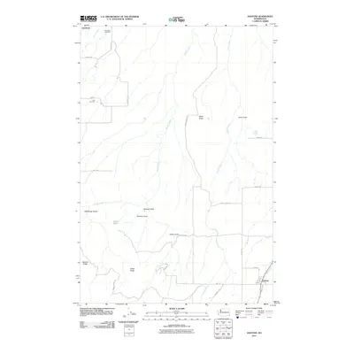
2011 Map of Anatone
USGS Topo · Published 2011About this map
Anatone stands as the primary settlement in this southeastern corner of Washington, situated at the junction of several local routes in a landscape deeply carved by drainage systems. The surrounding high ground is defined by a series of prominent landforms named for local figures and families, including Meyer Ridge, Bennett Ridge, and Huber Ridge. These ridges are separated by steep-sided gulches such as Heffelfinger Gulch and Wormell Gulch, which channel water toward George Creek and Pintler Creek.
Find a feature on this map
35 named features on this map. Tap any name to fly to it.
Don’t see what you’re looking for? This feature index may not catch every label — zoom into the map to look around manually.
Map Details
Editions of this 2011 Anatone Map
This is the sole edition of this map. No revisions or reprints were ever made.
Other maps of this area

1943 · Peola
USGS Topo · 1:62,500

1943 · Saddle Butte
USGS Topo · 1:62,500

1944 · Anatone
USGS Topo · 1:62,500

1945 · Clarkston
USGS Topo · 1:62,500

1946 · Saddle Butte
USGS Topo · 1:62,500

1946 · Peola
USGS Topo · 1:62,500

1946 · Anatone
USGS Topo · 1:62,500

1948 · Clarkston
USGS Topo · 1:62,500

1955 · Pullman
USGS Topo · 1:250,000

1958 · Pullman
USGS Topo · 1:250,000