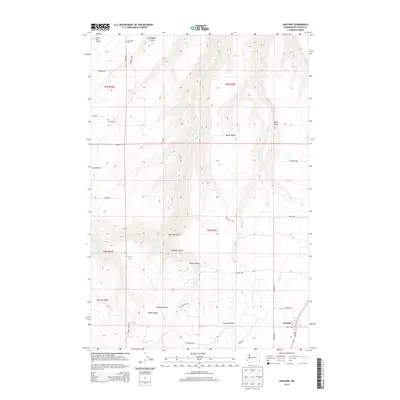
2014 Map of Anatone
USGS Topo · Published 2014About this map
Anatone occupies the southeastern corner of this Asotin County landscape, where the plateau begins its descent toward the deeply incised drainages of George Cr and Pintler Cr. The terrain is characterized by a series of prominent ridges and gulches, including Meyer Ridge, Bennett Ridge, and Wormell Gulch, which dictate the winding paths of rural routes like Wa-129. For genealogists and local historians, the presence of Cloverland Cem in the northwest and Lake Cem near the central west provide specific points of interest for family research. Small-scale water features like Huber Lake and Huber Spring appear tucked among the ridges, while Hawks Run Airport serves as a modern landmark in the more level northern reaches. The survey captures a high-elevation plateau defined by traditional land divisions and a sparsely populated network of ranch roads.
Find a feature on this map
38 named features on this map. Tap any name to fly to it.
Don’t see what you’re looking for? This feature index may not catch every label — zoom into the map to look around manually.
Map Details
Editions of this 2014 Anatone Map
This is the sole edition of this map. No revisions or reprints were ever made.
Other maps of this area

1943 · Peola
USGS Topo · 1:62,500

1943 · Saddle Butte
USGS Topo · 1:62,500

1944 · Anatone
USGS Topo · 1:62,500

1945 · Clarkston
USGS Topo · 1:62,500

1946 · Saddle Butte
USGS Topo · 1:62,500

1946 · Peola
USGS Topo · 1:62,500

1946 · Anatone
USGS Topo · 1:62,500

1948 · Clarkston
USGS Topo · 1:62,500

1955 · Pullman
USGS Topo · 1:250,000

1958 · Pullman
USGS Topo · 1:250,000