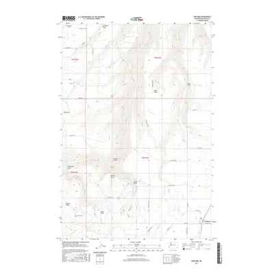
2017 Map of Anatone
USGS Topo · Published 2017About this map
Anatone anchors the southeastern corner of this Asotin County landscape, where the plateau meets a complex network of drainage systems and ridges. The terrain is defined by deep incisions such as Stringtown Gulch, Heffelfinger Gulch, and Wormell Gulch, which feed into major watercourses like George Creek and Pintler Creek. Local family names and early settlement history are reflected in landmarks such as Meyer Ridge, Bennett Ridge, and Huber Ridge, along with the small Huber Lake and Huber Spring. This area maintains its rural character with a grid of country roads including Sangster Road and Pine Grove Road, connecting isolated sites like the Hawks Run Airport. For those researching local heritage, the map identifies established burial grounds including Cloverland Cemetery and Lake Cemetery, providing specific points of interest for genealogical study within this high-elevation agricultural and ranching district.
Find a feature on this map
42 named features on this map. Tap any name to fly to it.
Don’t see what you’re looking for? This feature index may not catch every label — zoom into the map to look around manually.
Map Details
Editions of this 2017 Anatone Map
This is the sole edition of this map. No revisions or reprints were ever made.
Other maps of this area

1943 · Peola
USGS Topo · 1:62,500

1943 · Saddle Butte
USGS Topo · 1:62,500

1944 · Anatone
USGS Topo · 1:62,500

1945 · Clarkston
USGS Topo · 1:62,500

1946 · Saddle Butte
USGS Topo · 1:62,500

1946 · Peola
USGS Topo · 1:62,500

1946 · Anatone
USGS Topo · 1:62,500

1948 · Clarkston
USGS Topo · 1:62,500

1955 · Pullman
USGS Topo · 1:250,000

1958 · Pullman
USGS Topo · 1:250,000