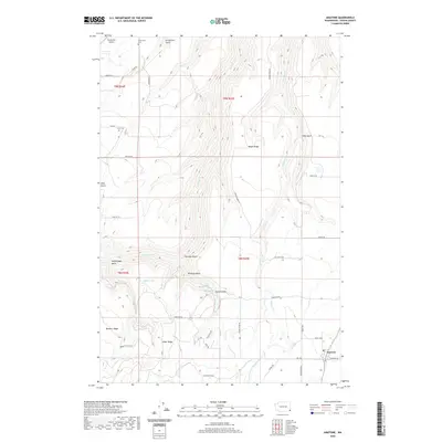
2020 Map of Anatone
USGS Topo · Published 2020About this map
Anatone anchors the southeastern corner of this Asotin County landscape, where the plateau terrain is deeply incised by a network of drainages and prominent ridges. To the north, Cloverland Cem and Lake Cem serve as important genealogical markers for the rural communities that historically settled this high country. The topography is defined by significant elevations like Meyer Ridge, Bennett Ridge, and Huber Ridge, which overlook a series of steep gulches including Stringtown Gulch and Heffelfinger Gulch. Water resources are sparse but notable, featuring Huber Lake, Huber Spring, and the winding paths of George Cr and Pintler Cr. The map reveals a transition between agricultural land and more complex terrain, evidenced by the scattered road network connecting remote points such as Hawks Run Airport to the township center. This survey provides a clear view of the land use patterns and topographical barriers that have shaped the development of this corner of Washington.
Find a feature on this map
42 named features on this map. Tap any name to fly to it.
Don’t see what you’re looking for? This feature index may not catch every label — zoom into the map to look around manually.
Map Details
Editions of this 2020 Anatone Map
This is the sole edition of this map. No revisions or reprints were ever made.
Other maps of this area

1943 · Peola
USGS Topo · 1:62,500

1943 · Saddle Butte
USGS Topo · 1:62,500

1944 · Anatone
USGS Topo · 1:62,500

1945 · Clarkston
USGS Topo · 1:62,500

1946 · Saddle Butte
USGS Topo · 1:62,500

1946 · Peola
USGS Topo · 1:62,500

1946 · Anatone
USGS Topo · 1:62,500

1948 · Clarkston
USGS Topo · 1:62,500

1955 · Pullman
USGS Topo · 1:250,000

1958 · Pullman
USGS Topo · 1:250,000