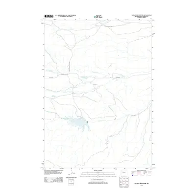
2012 Map of Anchor Reservoir
USGS Topo · Published 2012About this map
Anchor Reservoir serves as the hydrological focal point of this ranching landscape in Hot Springs County, where the north, middle, and south forks of Owl Creek converge. The terrain is defined by a sparse but essential network of water management features, including Blonde Reservoir and Adams Number 2 Reservoir, which support the livestock operations at Basin Ranch. These early 21st-century water resources are connected by a series of graded routes such as Eagle Nest Ranch Rd and Merritt Pass Rd, tracing the drainage basins of Goat Creek and Carney Creek. The map documents a land of carefully managed runoff and isolated homesteads, where the naming of every ephemeral fork and small-scale dam reflects the critical importance of water rights and ranching boundaries in the high Wyoming plains.
Find a feature on this map
16 named features on this map. Tap any name to fly to it.
Don’t see what you’re looking for? This feature index may not catch every label — zoom into the map to look around manually.
Map Details
Editions of this 2012 Anchor Reservoir Map
This is the sole edition of this map. No revisions or reprints were ever made.
Other maps of this area

1913 · Grass Creek Basin
USGS Topo · 1:62,500

1915 · Grass Creek Basin
USGS Topo · 1:62,500

1952 · Antelope Ridge
USGS Topo · 1:24,000

1952 · Sheep Ridge
USGS Topo · 1:24,000

1952 · Bargee
USGS Topo · 1:24,000

1955 · Thermopolis
USGS Topo · 1:250,000

1956 · Milk Creek
USGS Topo · 1:24,000

1956 · Twentyone Creek
USGS Topo · 1:24,000

1958 · Thermopolis
USGS Topo · 1:250,000

1962 · Thermopolis
USGS Topo · 1:250,000