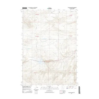
2015 Map of Anchor Reservoir
USGS Topo · Published 2015About this map
The High Desert landscape of Hot Springs County is defined here by the intricate drainage systems of the Owl Creek Mountains. Anchor Reservoir sits as a central water feature, collecting flow from the S Fork Owl Cr and Middle Fork Owl Cr. This network of tributaries, including N Fork Owl Cr and Rattlesnake Cr, illustrates the hydrological challenges and engineering responses in this arid region. Smaller impoundments like Blonde Reservoir and Adams-Number 2 Reservoir are scattered across the terrain, supporting local ranching and water management. To the north, the elevation levels out at Putney Flat near the course of Cottonwood Cr, while isolated roads like Owl Creek Rd and W Cottonwood Rd provide the only significant access through these sprawling township and range sections.
Find a feature on this map
21 named features on this map. Tap any name to fly to it.
Don’t see what you’re looking for? This feature index may not catch every label — zoom into the map to look around manually.
Map Details
Editions of this 2015 Anchor Reservoir Map
This is the sole edition of this map. No revisions or reprints were ever made.
Other maps of this area

1913 · Grass Creek Basin
USGS Topo · 1:62,500

1915 · Grass Creek Basin
USGS Topo · 1:62,500

1952 · Antelope Ridge
USGS Topo · 1:24,000

1952 · Sheep Ridge
USGS Topo · 1:24,000

1952 · Bargee
USGS Topo · 1:24,000

1955 · Thermopolis
USGS Topo · 1:250,000

1956 · Milk Creek
USGS Topo · 1:24,000

1956 · Twentyone Creek
USGS Topo · 1:24,000

1958 · Thermopolis
USGS Topo · 1:250,000

1962 · Thermopolis
USGS Topo · 1:250,000