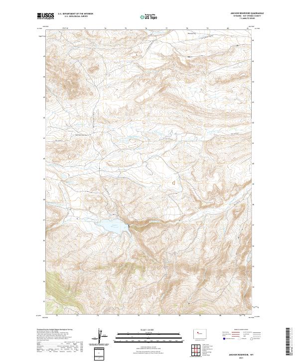
2021 Map of Anchor Reservoir
USGS Topo · Published 2021About this map
Anchor Reservoir serves as a focal point for water management in this high-elevation landscape within Hot Springs County. The surrounding terrain is defined by the complex drainage of the Owl Creek system, including S Fork Owl Cr, N Fork Owl Cr, and Middle Fork Owl Cr. Smaller impoundments like Blonde Reservoir and Adams Number 2 Reservoir reflect the region's reliance on managed water resources for ranching and livestock.
Find a feature on this map
22 named features on this map. Tap any name to fly to it.
Don’t see what you’re looking for? This feature index may not catch every label — zoom into the map to look around manually.
Map Details
Editions of this 2021 Anchor Reservoir Map
This is the sole edition of this map. No revisions or reprints were ever made.
Other maps of this area

1913 · Grass Creek Basin
USGS Topo · 1:62,500

1915 · Grass Creek Basin
USGS Topo · 1:62,500

1952 · Antelope Ridge
USGS Topo · 1:24,000

1952 · Sheep Ridge
USGS Topo · 1:24,000

1952 · Bargee
USGS Topo · 1:24,000

1955 · Thermopolis
USGS Topo · 1:250,000

1956 · Milk Creek
USGS Topo · 1:24,000

1956 · Twentyone Creek
USGS Topo · 1:24,000

1958 · Thermopolis
USGS Topo · 1:250,000

1962 · Thermopolis
USGS Topo · 1:250,000