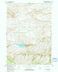
1965 Map of Anchor Reservoir
USGS Topo · Published 1992About this map
Anchor Reservoir dominates this high-altitude landscape in the mid-1960s, serving as a critical water management feature just north of the Wind River Indian Reservation Boundary. The surrounding terrain is defined by the convergence of several major waterways, including the North Fork Owl Creek, Middle Fork Owl Creek, and South Fork Owl Creek. These drainages represent the vital lifelines for ranching and early energy development in this part of Hot Springs County.
Find a feature on this map
15 named features on this map. Tap any name to fly to it.
Don’t see what you’re looking for? This feature index may not catch every label — zoom into the map to look around manually.
Map Details
Editions of this 1965 Anchor Reservoir Map
This is the sole edition of this map. No revisions or reprints were ever made.
Other maps of this area

1913 · Grass Creek Basin
USGS Topo · 1:62,500

1915 · Grass Creek Basin
USGS Topo · 1:62,500

1952 · Antelope Ridge
USGS Topo · 1:24,000

1952 · Sheep Ridge
USGS Topo · 1:24,000

1952 · Bargee
USGS Topo · 1:24,000

1955 · Thermopolis
USGS Topo · 1:250,000

1956 · Milk Creek
USGS Topo · 1:24,000

1956 · Twentyone Creek
USGS Topo · 1:24,000

1958 · Thermopolis
USGS Topo · 1:250,000

1962 · Thermopolis
USGS Topo · 1:250,000