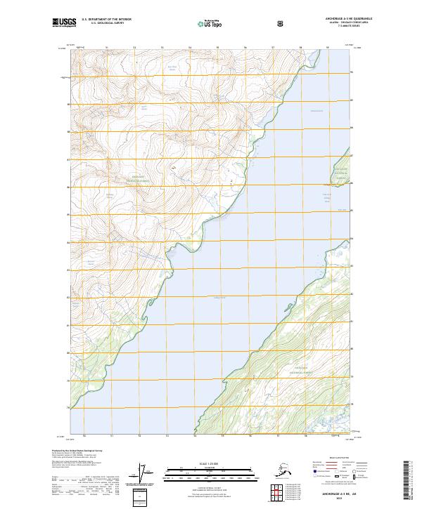
2023 Map of Anchorage A-3 NE
USGS Topo · Published 2023About this map
College Fiord and its dramatic glacial arms dominate this maritime landscape within the Chugach National Forest. The map documents a specific glacial topography where massive ice flows are named for prestigious universities, including Barry Glacier, Bryn Mawr Glacier, and Vassar Glacier along the western shore. This naming convention extends across the water to the eastern inlets of Harvard Arm and Yale Arm, split by the prominent College Point.
Find a feature on this map
17 named features on this map. Tap any name to fly to it.
Don’t see what you’re looking for? This feature index may not catch every label — zoom into the map to look around manually.
Map Details
Editions of this 2023 Anchorage A-3 NE Map
This is the sole edition of this map. No revisions or reprints were ever made.
Other maps of this area

1951 · Anchorage
USGS Topo · 1:250,000

1960 · Anchorage A-2
USGS Topo · 1:63,360

1960 · Anchorage A-3
USGS Topo · 1:63,360

1960 · Anchorage B-3
USGS Topo · 1:63,360

1960 · Anchorage B-2
USGS Topo · 1:63,360

1962 · Anchorage
USGS Topo · 1:250,000

1979 · Anchorage
USGS Topo · 1:250,000

2013 · Anchorage B-2 SW
USGS Topo · 1:25,000
2013 · Anchorage B-3 SE
USGS Topo · 1:25,000
2013 · Anchorage A-3 NW
USGS Topo · 1:25,000